|
News from the field ,
pictures
|
|
May 2nd:BP_T3 reached
today its maximum planned duration of 56 days flight and
was therefore automatically terminated.
|
|
April 18th: BP_D2 (the
test of heavy payload) fell today at 58S, 115W in the South
Pacific after a 37-day flight.
|
|
April 7th: The
MIR-SAOZ1 payload landed on 14 February in Kimberley,
Australia,was returned today at the laboratory. The data
stored on-board have been downloaded for further analysis.
|
|
April 7th: BP_O3
landed today after 27 days at 77S, 28W in Antarctica. The
origin of the fall is the depressurisation of the balloon
at warm temperature in the autumn polar night when flying
above the cold IR emitting Antarctic plateau. The payload
is still transmitting on the ice, including air temperature
of -31¡C.
|
|
April 6th: BP_T2
stopped working today after 53 days after emptied its
batteries (30 days planned). The payload was automatically
cut by the safety system over Queensland, Australia.
|
|
April 6th :The
MIR-SAOZ 2 flight fell down after a 39-day flight into the
Pacific 800 km North of Tahiti at 150W, 9S. The balloon was
automatically cut-down at 16 km after a fast descent from
26 to 16 km in 40 minutes at sunset. Such unexpected fast
descent, similar to that already observed earlier on the
MIR microlidar and on several other balloons in the past,
cannot be explained by pure cooling over high altitude
clouds. It suggests some instability, eg a volume reduction
at high vertical speed at the beginning of the descent at
sunset, which will need further investigation. All
instruments, SAOZ, IR radiometer, lightning detector and
meteorological sensors have been operating during the whole
flight. High quality data of 70 occultations have been
gathered together, the longest series ever for a SAOZ-MIR
flight.
|
|
March 22nd: MIR-SAOZ2
is now over Amazonia (Mato Grosso) in a very active
thunderstorm area. Many lightning and blue-jets events have
been observed during the last two nights. The balloon was
followed by radar on the 19th from Maceio (9¡S South
of Recife) by a Brazilian scientist previously working at
IPMet in Bauru.
|
|
March 22nd: The
payload of SAOZ-MIR1 dropped on February 14th have been
recovered in Australia. It will be returned soon to
Toulouse for expertise as well as recovering of the raw
SAOZ data stored on-board.
|
|
March 22nd: The MIR
MICRO-LIDAR dropped into the Western Pacific half way
between New-Caledonia and Fiji on the 19th after a 9-day
flight. The MIR was cut-down automatically around 100 hPa
at the end of a fast descent over the very active South
Pacific Convergence Zone. The payload is still emitting,
likely floating.
|
|
March 17th: After 19
days of flight, the MIR-SAOZ2 is now in the middle of the
Atlantic. Since it drifted to more equatorial latitude, its
displacement becomes more dictated by the QBO currently of
West phase, meaning light or Eastward wind above 15 hPa and
Westward in the lower stratosphere. Accordingly, the MIR
moves very slowly, or backwards, at 28000 m during daytime
and Westwards at 50 km /h during nighttime around 24000 m
over the clear St Helen's High. The SAOZ is still working.
Among the 38 occultations which could be observed, 35
provided full O3/NO2/H2O profiles, while 3 of them are
missing for a reason unexplained at the moment.
|
|
March 17th: Six BPs
are still in flight for respectively 33, 16, 10, 9, 7 and 5
days, all showing no indication of significant loss of gas.
Although they are observed sometimes to lose their
superpressure for a while at night when cooling at
temperature 10-15¡C below ambient over very low
emitting high level clouds, they are flying smoothly.
Except the first (BP_T2) which is transmitting part of the
data only, all other payloads are working as anticipated.
The scientific return of passenger instruments (turbulence
on T2 and T3, ozone and water vapour on O2 and O3) is under
evaluation. The balloon trajectories which could be seen on
the web site suggests the presence of waves of different
types not always captured by meteorological analyses.
|
|
March 17th: The MIR
MICRO-LIDAR is now in flight for 6 days and has almost
crossed the Western Pacific. After waiting for 30 h to
avoid high voltage at very low pressure, the MICRO-LIDAR
was turned on. The instrument is working although spikes
could appear frequently, but not always, in the signal
particularly at the beginning, tentatively attributed to
electrostatic discharges. Currently about one third of the
profiles are free of noise displaying the complete picture
down to the ground. Until now, low altitude clouds only
could be observed but this could change rapidly since the
MIR is now overflying more active and cold tropopause
regions over Eastern Pacific. Since the MICRO-LIDAR is
activated every 5 minutes at night, exciting results could
be expected.
|
|
March 11th: MIR-SAOZ 2
passed about 350 km North of Reunion Island at 21:00 UT
where a dedicated ozonesonde could be launched.
Unfortunately, the cloud cover associated to the hurricane
GAFILO didn't allow to carry the anticipated lidar
observations. If clearing, a new attempt is anticipated for
tomorrow which could be compared to the MIR remote
measurements at sunrise 400 km backwards at about the
longitude of Reunion Island.
|
|
March 11th: BP_ D2, a
technical BP, was launched today at 21:00 UT. It reached
float at 18800 m (71 hPa) one hour later. This is the last
of a series of 18 launches of HIBISCUS balloons of various
types. Among them two MIRs and 6 BPs are still in flight.
See Last MIR positions and Last BP positions .
|
|
March 10th: The MIR
MICRO-LIDAR was successfully launched at 21h35 UT, with an
ascent in 2h21 up to 39000 m. The instrument is the
ENEA/CNR MICRO-LIDAR recovered and refurbished after the
launch failure on March 3rd. The balloon is a light MIR 46
(thinner material for the lower part, 20 kg less than
previous MIR 45), designed for safer flights over very high
convective clouds.
|
|
March 10th: MIR-SAOZ 2
passed successfully last night over the southern part of
the tropical storm "Nicky", and is heading now to Reunion
Island.
|
|
March 9th: At 21:00
UT, launch of BP_O3, the third and last 8.50 m diameter
balloon carrying UCAM O3 and H2O sensors. The balloon
surpressurised smoothly at float at 18400 m (74.4 hPa).
Transmission and all meteorological sensors are working
fine.
|
|
March 9th: The
MIR-SAOZ2 is now over the Indian Ocean where it is expected
to pass through a hurricane in formation at 14S, 90E and
later GAFILO, currently over Madagascar. The prediction
shows that it should pass close to Reunion Island on the
11th at 16:00 UT. The station of Reunion Island is planning
two ozonesonde ascents (the regular weekly sonde on
Wednesday 10th and another one on the 11th in the
afternoon) as well as to run the tropospheric ozone and the
temperature/aerosols/water vapour lidar.
|
|
March 7th: At 12:00
UT, launch of BP_T3, the third 10 m diameter balloon
carrying a LMD turbulence sensor. The balloon reached float
1h30 mn later at 19800 m (58.6 hPa) where it pressurised
smoothly. Ambient temperature is -70C.
|
|
March 6th: IPMet
launched an ozone sonde at 16:30 UT for the calibration of
the BP_O2 SS ozone sensor.
|
|
March 6th: At 15:45
UT, launch of BP_O2, the second 8.50 m diameter balloon
carrying a UCAM SS ozone and SAW water vapour sensors. The
balloon reached float 1h05 mn later at 18450 m (73.6 hPa)
where it pressurised smoothly. Ambient temperature is -73C.
The balloon is heading to the West.
|
|
March 3rd: The MIR
MICRO-LIDAR was launched today at 00h30 UT. Unfortunately,
because of humidity on the balloon after rainfall during
the operations, the MIR burst at 9 km altitude. The payload
has been recovered. The possibility to fly it again using a
spare MIR is under investigation.
|
|
February 29th:The
MIR-SAOZ2 is now over the Pacific. The data transmitted
during the first two days flight show that all instruments
are performing 100%: SAOZ ozone, nitrogen dioxide and water
vapour profiles down to 5 km in clear sky conditions, the
IR radiometer as well as the newly designed lightning and
blue-jet detectors.
|
|
February 29th: A
technical 10 m diameter BP was flown including
modifications to correct the default of transmission
experienced on the past two flights. The balloon reached
float at 55 hPa (20160 m) and the transmitter is performing
well. If confirmed tomorrow the launch of the remaining BPs
could restart.
|
|
February 26th: At
23:30 UT, successful ozonesonde up to 30 km and IPEN
aerosol lidar.
|
|
February 26th: At
23:00 UT, launch of MIR-2. At float at 37000 m 2:40 h
later. Instruments : SAOZ, lightning and blue jet optical
sensors and IR radiometer. Rendez vous with TROCCINOX
Falcon at SAOZ tangent point tomorrow morning.
|
|
February 26th: At
20:00 UT, launch of SF3 flight. At float at 21700 m one
hour later, followed by a long and slow descent across the
TTL and the UT. Instruments: UCAM DESCARTES SLS and
micro-DIRAC, CNR-ISAC LABS backscatter diode laser, UCAM
SAW and SSS and NPL TDLAS.
|
|
February 25th: The
NILUCUBE was launched around noon local time (15:07 UT) as
the cloud coverage was high with the SACZ above us. After a
slow descent under a large parachute, the payload has been
recovered in good shape 40 km South of Bauru. The recovery
team is on his way back to IPMet.
|
|
February 25th: The SF4
payloads were recovered this morning and brought back to
IPMet this afternoon. They are in very good shape thanks to
a smooth landing. Data analyses are under way.
|
|
February 24th,
Carnaval flight: The South
Atlantic Convergence Zone is still over us and we found
good surface conditions (no rain and light wind) to launch
SF4 at 20:00 UT. The balloon was carrying the UCAM DIRAC GC
in SLS version with the ENEA MICRO-LIDAR on its back, the
CNRS-CETP AIRS electric field and optical lightning sensor
, a UCAM SAW hygrometer/SS ozone sensor and the CNRS-SA
tuneable diode laser MICRO-SDLA for CH4, H2O and CO2. The
balloon reached 20.5 km at 21:02 UT 1 hour before sunset.
It flew above anvils topping at 13.5 km ahead of very
convective cells moving toward the balloon. After a 2h30
descent down to 11 km, cut-down was activated for a descent
under parachute and then a smooth landing 150 km South East
of Bauru.
|
|
February 24th: A
DMI/U. Wyoming backscatter sonde(#10) launched at 22:30 UT
was flown successfully, reaching 28 km altitude.
|
|
February 23rd: A
DMI/U. Wyoming backscatter sonde(#9) launched at 22:30 UT
was flown successfully, reaching 27 km altitude.
|
|
February 23rd: The
convergence zone is over us with good scientific conditions
for SF4 and SF3. Two attempts to fly SF4 yesterday and
today, but both flights had to be cancelled during the
operations due to rain on Sunday and wind this afternoon.
|
|
February 21st: A
DMI/U. Wyoming backscatter sonde(#8) launched at 22:30 UT
was flown successfully, reaching 33 km altitude.
|
|
February 21st: A
DMI/U. Wyoming backscatter sonde(#7) launched at 00:00 UT
was flown successfully, reaching 27 km altitude.
|
|
February 19th: A
DMI/U. Wyoming backscatter sonde(#6) launched at 00:00 UT
was flown successfully, reaching 27 km altitude.
|
|
February 17th: The SF1
payloads were recovered early this morning and are now
under evaluation at IPMet. All instruments are in good
shape.
|
|
February 17th: A
DMI/U. Wyoming backscatter sonde(#5) launched at 00:00 UT
was flown successfully, reaching 27 km altitude.
|
|
February 16th: The SF1
balloon (See
pictures) was launched today at 20:25 UT with the
TROCCINOX Falcon 20 overpassing the area at 20:54 UT. The
balloon was carrying the UCAM DESCARTES air sampler in SLS
version with the CNR-ISAC LABS on its back, the CNRS-CETP
AIRS electric field and lightning sensor,the UCAM
micro-DIRAC GC, the UMIST Optical particle counter and a
UCAM SAW hygrometer/SS ozone sensor attached to the NPL
TDLAS tuneable diode laser system for H2O. The balloon
reached 20.5 km at sunset followed by a 6h very slow
descent down to 15.8 km where it was cut down close to the
border with Parana.
|
|
February 16th: A
DMI/U. Wyoming backscatter sonde(#4) launched at 00:00 UT
was flown successfully, reaching 27 km altitude.
|
|
February 14th: After a
9 day flight, the MIR-SAOZ 1 was automatically cut-down at
20:00 UT above a very active cell in NW Australia when
reaching the tropopause level a little before sunrise.
|
|
February 14th: The
front arrived in the late night above the station resulting
in extremely heavy rain (60 mm expected within 24h). The
SF2 flight train has been recovered 90 km North of Bauru,
partly at the top of a 30 m height eucalyptus tree. It has
required the intervention of firemen and people climbing on
the tree.
|
|
February 13th:The
DMI/U.Wyoming backscatter sonde(#3) was launched at 22:35
UT, reaching 27 km and passing the tropopause at 15 km with
good data reception. The IPEN lidar was also run in
parallel.
|
|
February 13th: The SF2
flight was flown at 20:16 UT just ahead of a very active
front expected to arrive above Bauru during the second half
of the night. The balloon of 3000 m3 was carrying the UCAM
DESCARTES air sampler in SLS version with the ENEA
MICRO-LIDAR on its back, the UCAM micro-DIRAC GC, a UCAM
SAW hygrometer/SS ozone sensor, and the CNRS SDLA tuneable
diode laser for H2O and CH4. The balloon reached 20 km at
sunset followed by a 3h slow descent through the whole TTL
down to 220 hPa (12km) where it was cut down. Since the
data of the instruments are stored on-board and not
transmitted, their quality will be evaluated after the
recovery.
|
|
February 13th: The
NILUCUBE was launched at 13:00 UT using a small plastic
balloon for radiation measurements in the whole UV-Vis-NIR
spectrum around noontime during the ascent up to 20 km an
then a slow descent below a large parachute. The payload
has been recovered in good shape in an orange field, 80 km
North of Bauru.
|
|
February 12th: The
second 10 m super-pressure balloon (BP_T2) carrying the
CNRS RUMBA payload and Turbulence detector was launched
successfully at 20:37 UT.
|
|
February 12th: The
first 8.5 m super-pressure balloon (BP_O1) carrying the
CNRS RUMBA payload and the UCAM O3/H2O passenger was
launched successfully at 16:15 UT reaching a float altitude
of 18500 m (72 hPa) and heading NW . See Last BP positions and 8.5 m BP forecast for actual and
predicted trajectory.
|
|
February 12th: A
DMI/U. Wyoming backscatter sonde(#2) was launched at 00:00
UT, going up to 28 km and passing the tropopause at 17.7 km
with temperatures down to -74 C. A thin cloud layer was
observed at 9 km, but no cloud occurrence was seen in the
TTL region. The IPEN Brazilian aerosols lidar got
simultaneaous measurements up to 25 km.
|
|
February 10th: A
science meeting took place today at IPMet with
representatives of HIBISCUS, TROCCINOX and TROCCIBRAS
teams. Presentations of results and modelling from previous
campaigns and current activities.
|
|
February 10th: A
backscatter sonde from DMI/U. Wyoming (#1) was launched
today at 00:45 UT. The balloon reached 28.5 km, passing the
tropopause at 17 km with temperatures down to -77C. Above
the boundary layer, thin cloud layers were observed between
6 and 9 km together with the lower part of the
stratospheric aerosol layer above the tropopause. The IPEN
Brazilian aerosols lidar got simultaneaous measurements up
to 30 km.
|
|
February 6th: A first
10 m super-pressure balloon (BP_T1) carrying the CNRS RUMBA
payload and a detector of Turbulence was launched
successfully at 15:00 UT reaching a float altitude of 20200
m (55 hPa) where it overpressurised. See Last BP positions and 10 m BP forecast for actual and predicted
trajectory.
|
|
February 6th: The
MIR-SAOZ1 is now located at 90 degrees West over the
cloud-free Eastern Pacific, loosing progressively its
helium as expected (nighttime altitude of 27 km instead of
32 km on the previous night). SAOZ runs smoothly in the
evening providing measurements down to 7 km, but
experiences some problems with the on-board spectral
analysis in the early morning.
|
|
February 6th: The
10ZL1 payloads were recovered and returned to IPMet this
morning. SAOZ is fine, SAOZ-BrO and DIRAC are damaged after
the rough lift-off. Their exact status is under
investigation.
|
|
February 5th: The
10ZL1 was launched today at 20:00 UT, carrying SAOZ,
SAOZ-BrO and the UCAM DIRAC GC for N2O. Good flight despite
rough lift-off ahead a squall line. Payload landed at 80 km
West from Bauru.
|
|
February 5th: The
MIR-SAOZ1 is now above Pacific after 24 hours of flight
over Paraguay, Bolivia and Chile.
|
|
February 4th: Launch
of MIR-SAOZ1 today at 21:46 UT. Smooth launch. The balloon
arrived at float at 32.8 km 2h 20' later heading to the
West at 140 km/h. Argos and Inmarsat transmissions, met
parameters and IR radiometer look fine. See Last MIR positions and MIR forecast for actual and predicted
trajectory.
|
|
February 2nd: The
first balloon flight of the HIBISCUS campaign took place on
Saturday afternoon, with the 10ZL2 flight (See
pictures). The balloon carrying the CNRS SAOZ, SAOZ-BrO
and the CNR-ISAC backscatter diode laser was launched at
18:30 local for a 1:20 daylight ascent, followed by 40 min
at float during twilight and a cut down 10 minutes later.
Everything went well. The payloads have been returned to
IPMet after their recovery in a sugar cane field on the
following morning. The three instruments performed
beautifully. The SAOZ's were able to carry their
measurements down to exceptionnally low altitude at sunset
because of the total absence of clouds around their tangent
point area over Paraguay, although massive convection is
still present over Eastern Brazil, Bauru being at the
limit. Note: the NILUCUBE originally planned on this flight
has been withdrawn. It will be flown on a small Raven
plastic balloon for getting a full day of measurements,
including at noon time, at 22 km instead of only twilight
conditions on the ZL.
|
|
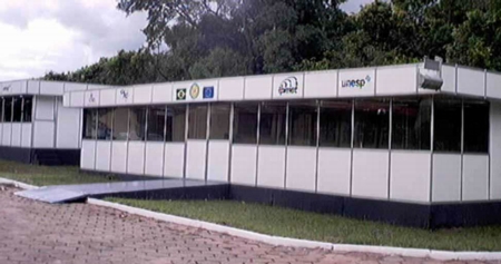
January 12th: The
temporary buildings are ready
|